THE FASCINATING WORLD of the Great Barrier Reef is being explored with a new scientific expedition called the Catlin Seaview Survey.
The survey looks at the reef, which is one of the seven wonders of the natural world, with the aim of carrying out the first comprehensive study to document and reveal the composition and health of the area.
It will take place across a depth range of 0 – 100m.
The Catlin Seaview Survey officially begins to broadcast its findings in September 2012. The chief scientist for the project, Professor Ove Hoegh-Guldberg from the Global Change institute at The University of Queensland, said:
For the first time in history, we have the technology available to broadcast the findings and expedition through Google. Millions of people will be able to experience the life, the science and the magic that exists under the surface of our oceans.
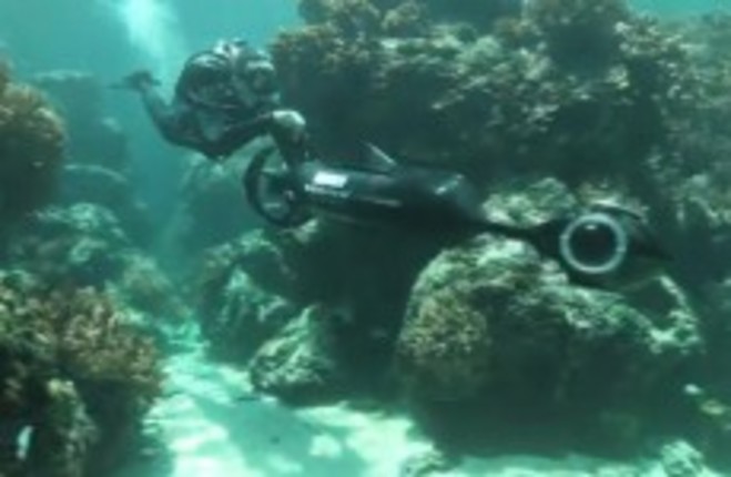
The reef is an indicator of how healthy the Earth’s oceans are, and to take an in-depth look at its health, the Catlin Seaview Survey camera was specially developed.
Called the SVII camera, it takes 360 degree gelo-located panoramic images every 4 – 6 seconds while travelling at a speed of around 4km/h. It will be used during the shallow reef survey.
During the deep reef survey, diving robots and HD cameras will explore the reef between 30 – 100 metres down, while the mega-fauna survey will study the migratory behaviour of tiger sharks, green turtles and manta rays in response to increasing seawater temperatures.
Google is collaborating on the survey, which includes a new feature on Panoramio so that the 360-degree images taken can be uploaded and then made available to millions of people worldwide through Google Earth and Google Maps.
There will also be a dedicated YouTube channel and people will be able to watch livestreams of the expedition team.
The survey will help to address questions regarding the changes associated with the rapidly warming and acidifying oceans, and will allow scientists and the public to explore the reef remotely through any device connected to the internet.
They will be able to choose a location, dip underwater, look around and go off on a virtual dive, say the team behind the survey.
