# Met Éireann
This week
21st July 2024 - 27th July 2024

Met Éireann has released its extended summer forecast - it's not looking great
Forecaster Linda Hughes said that there is hope for improvement in August or even September.
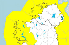
This month
July 2024


Last month
June 2024


Ireland has hottest May on record as world sees 12th consecutive month with warmest average
In Ireland, Met Éireann recorded an average temperature of 13.08 degrees Celsius in May 2024.
May
May 2024


April
April 2024


Around 12,000 premises still without electricity as Storm Kathleen hits Ireland
A Status Yellow wind warning is in place for the entire country.
ESB Networks is working to restore power to thousands of premises
Dozens of flights between Ireland and the UK have been cancelled or delayed
The RSA has urged road users to take caution if travelling during the storm


Storm Kathleen: Here’s what you need to know as today’s storm warnings kick in
A Status Orange wind warning will impact five counties, with a Yellow warning for the rest of the country.


It was a majorly wet March - with 219% rain compared to average at Dublin Airport weather station
Two weather stations in Clare and Cavan recorded 29 rainy days each last month.

March
March 2024